

This post was originally published on this site.
 BBC Weather Watchers/MattFacey
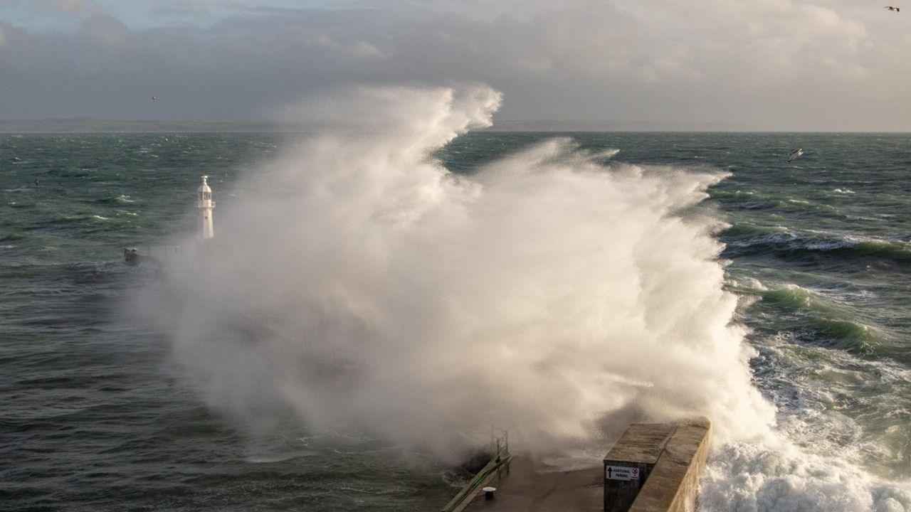
Severe weather warnings for wind and rain have been issued ahead of the expected arrival of Storm Chandra.
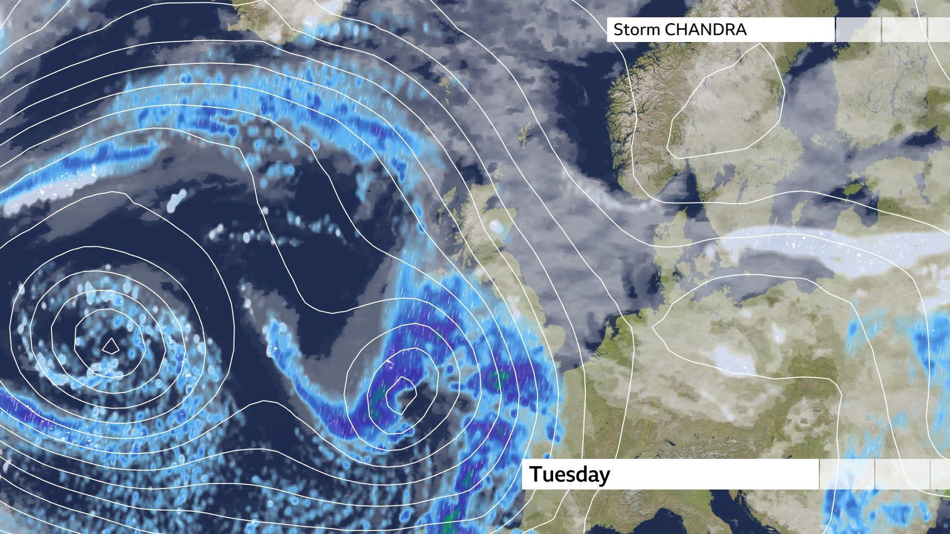
Chandra has been named by the UK Met Office and is due to hit the UK on Tuesday.
It is the third major storm to hit the UK this month after Goretti and Ingrid, which caused significant damage and disruption.
Chandra will be accompanied by multiple hazards, widely heavy and persistent rain, and gales or even severe gales in exposed areas.
Severe weather warnings issued
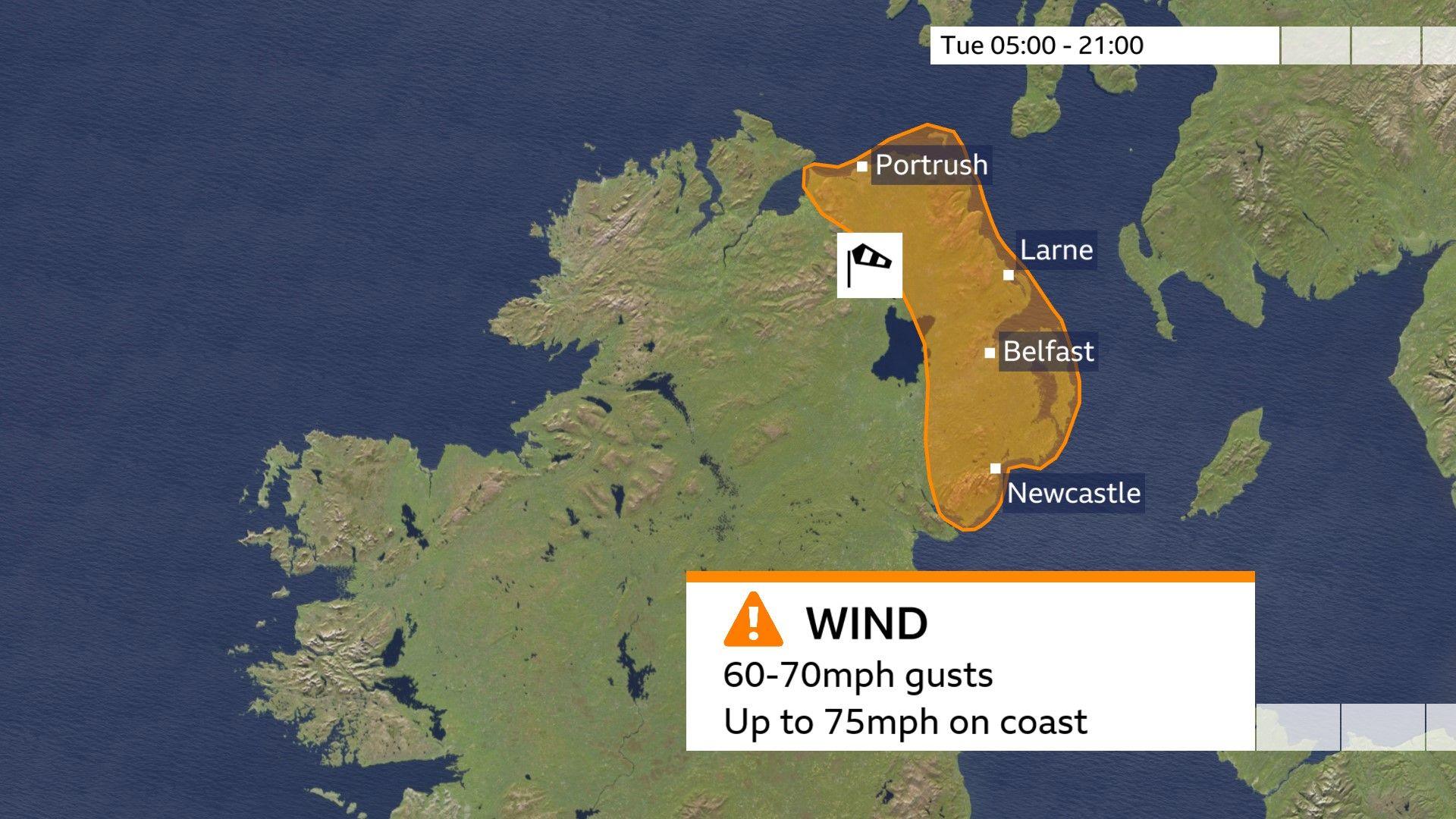
The Met Office has issued an amber wind warning for Northern Ireland to accompany Storm Chandra.
The warning is in place for eastern parts of Northern Ireland, from 05:00 on Tuesday until 21:00.
Winds will escalate with coastal gales, even severe gales and damaging gusts of up to 75mph (120km/h).
These sort of wind speeds will lead to large coastal waves which are likely to overtop the sea walls and promenades.
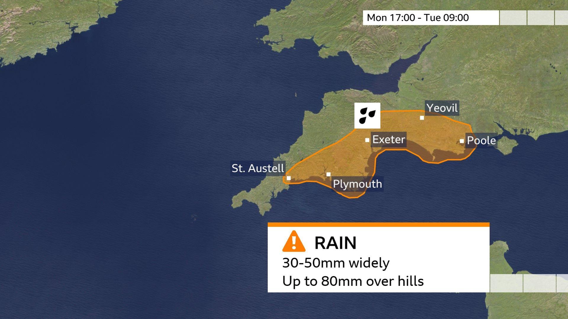
It has also issued an amber warning for heavy rain from 17:00 Monday until 09:00 Tuesday for south-west England.
30-50mm rainfall is likely widely, with 60-80mm across some higher ground, especially south Dartmoor.
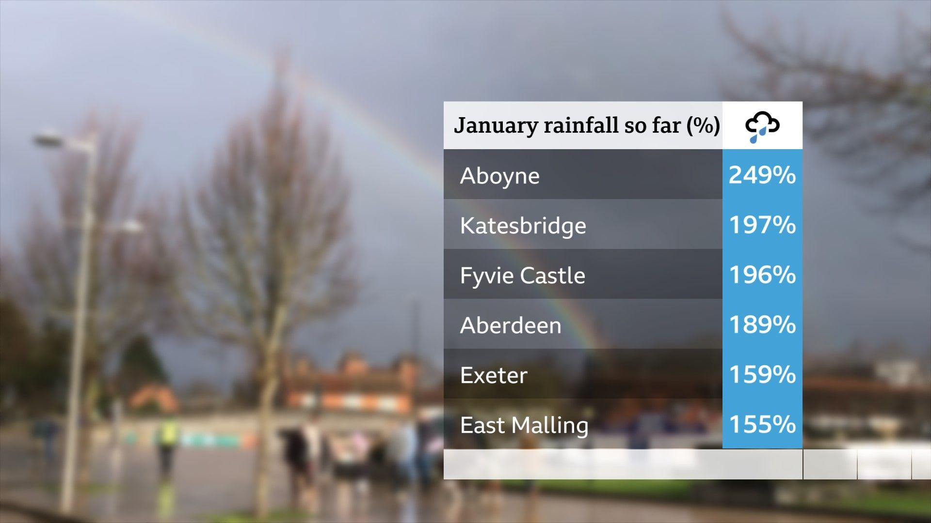
These areas have already had a large amount of rain, so there is a risk of flooding as more rain falls on ground that is currently saturated.
Further warnings issued
Yellow warnings – the least severe level of warning – are more numerous:
-
Northern Ireland, valid from 12:00 Monday until 18:00, for persistent rain and flood risk with 10 to 20mm widely, up to 40mm over the hills.
-
South-west England, Wales and parts of central southern England valid from 13:00 Monday until 10:00 Tuesday, for 20 to 30mm widely, but as much as 80mm over Dartmoor, Exmoor and Bannau Brycheiniog (Brecon Beacons).
-
London and south-east England, valid from midnight Tuesday until midday and mentions 15 to 25mm of rain widely, with twice as much over higher ground such as the Chilterns.
-
Northern Ireland, valid Tuesday 00:00 until 23:59, for damaging winds, gusts in exposed parts up to 70mph (113km/h) accompanied by another 20 to 30mm of rain widely, 50 to 70mm over the hills.
-
South-west England and West Wales, valid 05:00 Tuesday until 16:00 for very strong winds.
-
Hilly areas of central and northern England, southern Scotland, valid Tuesday from midnight until 17:00 for heavy rain, 20 to 30mm widely and more in a few spots. This rain will turn to snow over the hills, up to 5cm on hills around 300 metres and more on higher routes. Drifting is likely with the brisk winds.
-
South-west Scotland, Lothian Borders and Strathclyde, valid Tuesday 05:00 until 23:59 for strong winds causing disruption.
-
Parts of Scotland valid Tuesday from 06:00 until 23:59 for heavy rain and hill snow, rainfall amounts of 20 to 35 mm widely and more in some places. 2 to 5cm of snow for hills around 300 metres and 10 to 20cm above 500 metres. The brisk southeast winds will also blow the snow around reducing visibility.
Much of this wet weather comes on after some very wet weather in recent days and weeks and so there is a high chance we will see significant impacts, such as:
-
Air, sea and rail delays or cancellations
-
Spray and flooding on roads
-
Interruption or damage to power supplies
-
Flooding of some homes and business
-
A few communities might be cut off by flooded roads
-
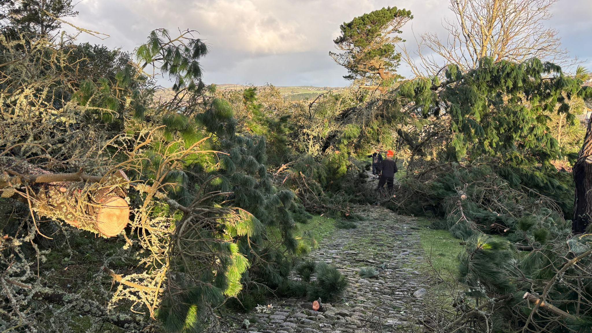
Trees could be damaged or blown down, especially where vulnerable following recent stormy weather
-
Landslides are also possible in prone locations
-
Minister gives storm resilience assurances
-
6 hours ago
-
Is flooding likely?
Storm Chandra is hitting hot on the heels of Goretti and Ingrid, bringing more soaking rains with little time between for the water to flow away and the rivers fully recover.
This continuing rain really heightens the flood risk.
The wind will also be a threat, as strong winds from Goretti and Ingrid have already battered parts of the UK this month, notably in south-west England.
As a result, many structures may have been weakened, trees may have been left vulnerable as well as power lines.
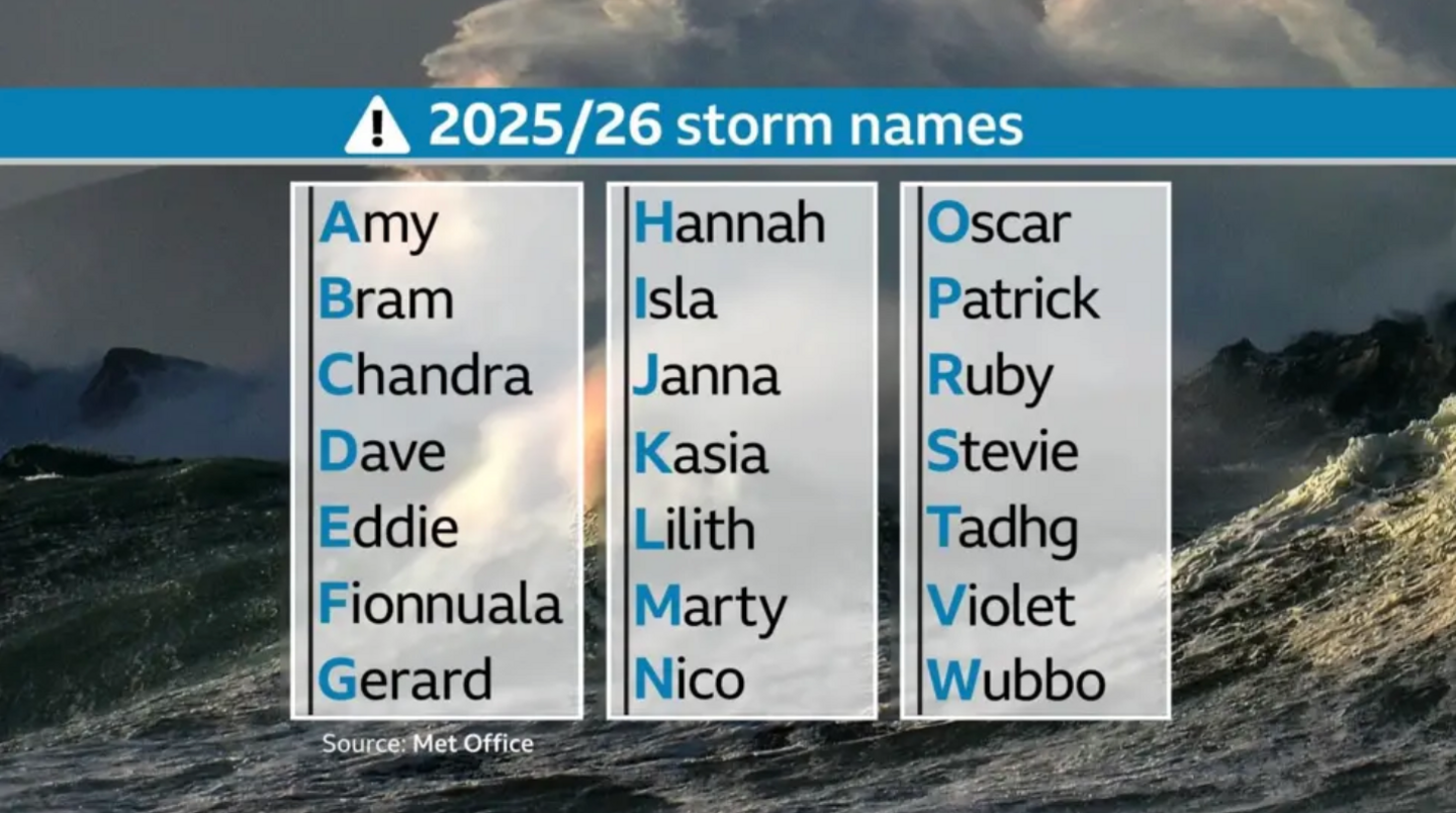
Why has the storm been named Chandra?
 BBC / Getty images
In the UK, the Met Office work with Ireland’s Met Éireann or the Netherlands’ KNMI in naming a storm when they are forecast to cause “medium” or “high” impacts.
The list of storm names is announced on 1 September each year and runs in alphabetical order.
The season started with Amy in October, followed by Bram in early December 2025.
Next names on our list will be Dave, Eddie and Fionnuala.
-
-
4 days ago
-


")