

This post was originally published on this site.
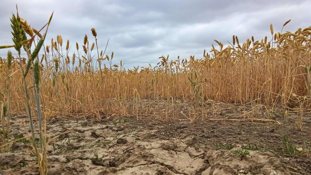
Driest July on record for England and Wales
-
Published
July 2026 was the driest for England and Wales since records began 190 years ago, according to the Met Office, external.
England recorded just 6.5mm of rainfall and Wales had 9.3mm, both less than half of the previous records for the nations.
The dry conditions have been accompanied by exceptional warmth across much of the UK. It was the second warmest July for the UK as a whole and Wales’ warmest ever.
The month was also the UK’s sunniest July on record. For England and Wales, it was the sunniest calendar month ever observed.
So far this year, six months of 2026 have seen above average sunshine hours for the UK, with just February seeing below the monthly average.
Heat health alerts
The dry, warm and sunny conditions continue into the first week of August, with a brief heat spike likely to lead to some parts of England being declared in official heatwave conditions.
Amber and yellow heat health alerts are now in effect across much of England, with temperatures expected to reach 34C in some areas.
The amber alerts, external, issued by the UK Health Security Agency, cover London, the south east, the east of England and the East Midlands, until 0900 BST on Wednesday 5 August.
They warn that significant impacts are likely across health and social care services due to the high temperatures, including a rise in deaths, particularly among vulnerable people.
Less severe yellow heat heat alerts have also been issued for the same period for the north west, Yorkshire and the Humber, West Midlands and the south west.
Thunderstorms for some
A yellow thunderstorm warning has been issued by the Met Office for parts of Northern Ireland on Tuesday.
It will run from 12:00 to 21:00 when up to 30mm of rain in an hour or two is possible along with strong winds and maybe hail.
A surge of heat on Monday
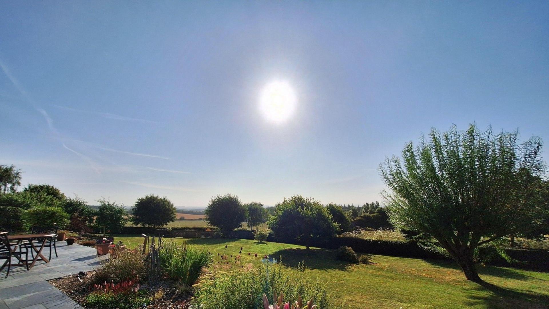 Image source, BBC Weather Watchers / Buffy’s Place
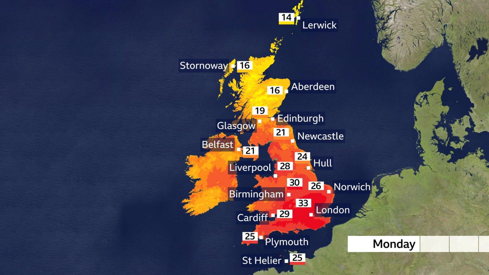
Monday will bring the warmest weather of the week, with a surge of hot air moving north from France ahead of an approaching Atlantic low-pressure system.
With southern and eastern parts of England widely reaching low to mid-30sC and a few locations across London and the Home Counties likely to reach 34C.
Much of the Midlands, East Anglia and southern England will see temperatures reach around 30C or above, while eastern parts of Wales will also experience unusually hot conditions.
Scotland, Northern Ireland and western Britain will experience cloudier skies with outbreaks of rain as low pressure slowly moves across Ireland.
Overnight into Tuesday, rain in northern and western areas is expected to become locally heavy and thundery.
Further south, most places will stay dry, warm and humid, although a few thunderstorms could develop across south-east England.
A little rain in the forecast
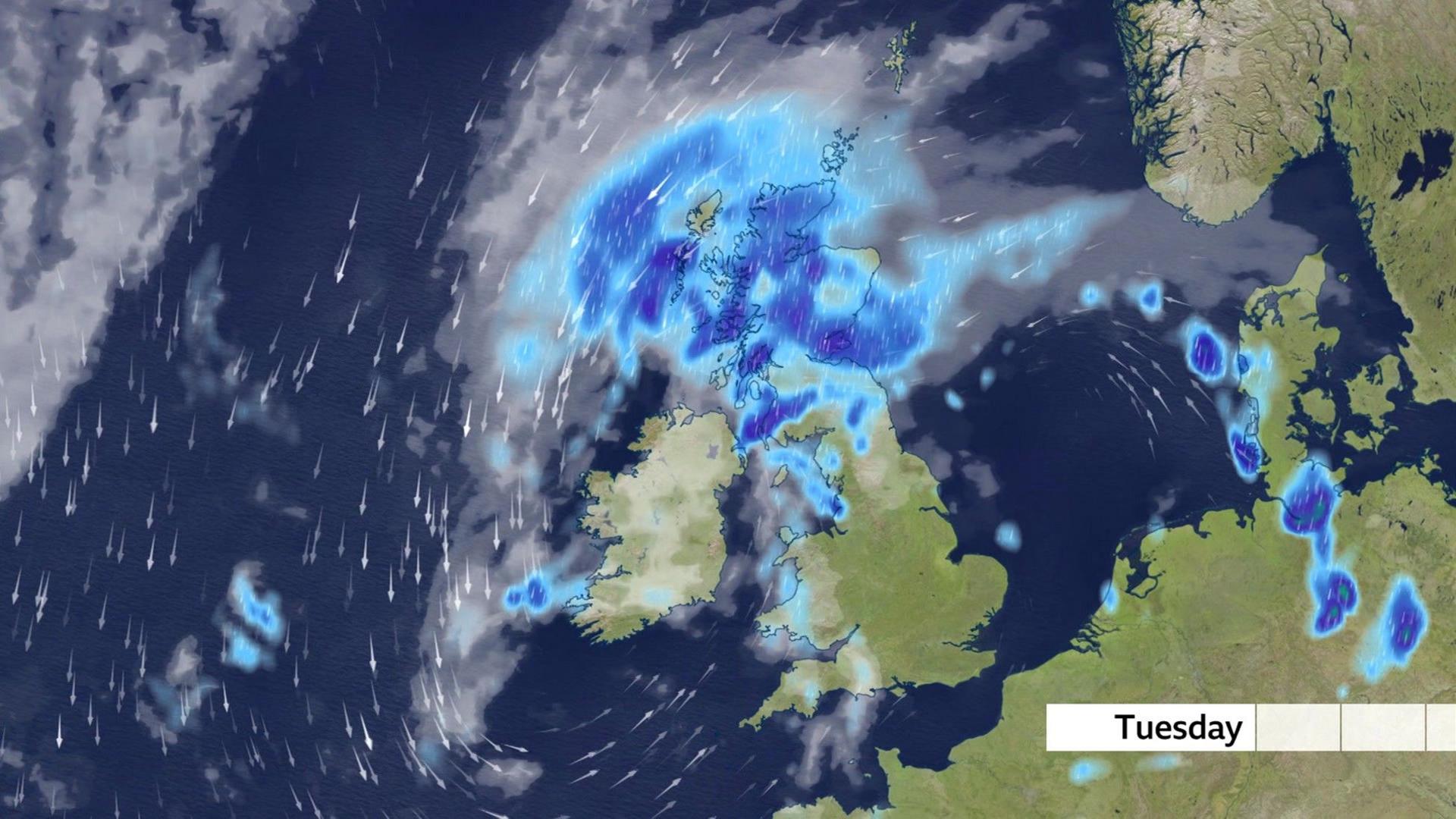
By Tuesday the low-pressure system will drift slowly north-eastwards, bringing another day of wet weather to northern parts of the UK.
Scotland is expected to bear the brunt of the rainfall once again, with prolonged heavy rain raising the risk of localised surface water flooding.
While some rain may spread into southern Britain, it is expected to be relatively light and patchy.
The hottest conditions will become confined to eastern England, where temperatures could still reach the low 30s Celsius, particularly across East Anglia and London.
Elsewhere across southern England and the Midlands, temperatures will ease back into the mid to high 20s Celsius, several degrees lower than Monday.
Cooler weather later in the week
A weak, cold front will bring cooler Atlantic air from midweek, ending the brief heat.
Scotland and Northern Ireland will see further heavy rain, while southern England stays warmer and mostly dry before more settled weather returns later in the week.
However, little rain is expected in the drought-hit south, with any showers unlikely to provide meaningful relief after one of England’s driest Julys on record.
Southern England has been particularly dry, seeing just 1.9mm in July – just 3% of its long-term average rainfall for the month. This makes it southern England’s driest month ever recorded.
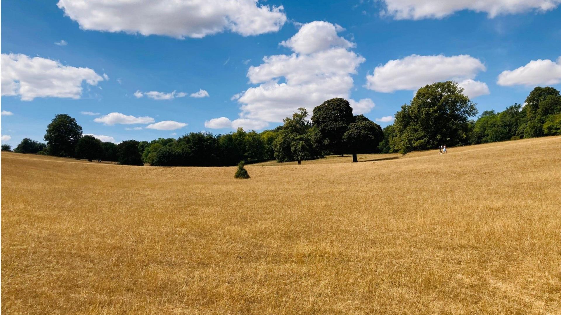 Image source, BBC Weather Watchers / TAG
Outlook for August
Looking beyond this week’s brief heat spike, August is expected to remain predominantly warm, dry and above average in temperature.
Although occasional showers and thunderstorms are likely, particularly in northern parts of the UK, the overall pattern favours further settled weather, especially across southern England, meaning drought conditions are likely to persist despite isolated bursts of rainfall.
The details of the longer-range forecast do look rather uncertain so it is worth keeping up to date with full local forecasts on the BBC Weather website and app.

Get in touch
How are you dealing with this latest heatwave? Let us know.
-
-
Published29 May
-
-
-
Published24 August 2025
-