

UK temperatures to rise to 23C before autumn chill sets in
 Image source, Peter Byrne/PA Wire
-
Published
Thursday will bring unusually high temperatures as warm air wafts across the south of the UK, while colder conditions dig into northern areas.
Afternoon highs in parts of eastern England are likely to be about 5-8C (9-14F) above typical mid-October values, probably peaking at 23C (73F).
It will be a different story further north and west with temperatures in much of Scotland and Northern Ireland sitting around the seasonal norm.
The two air masses are divided by a weather front which will bring outbreaks of rain. As that sinks southwards, chillier air will spread to all parts of the country bringing a colder feel to the weekend, though there will still be plenty of sunshine.
Frost and patchy fog are likely to develop in some locations.
Rain sinks slowly southwards
A weather front that has already brought rain to Scotland and Northern Ireland will edge slowly southwards on Thursday, meaning a soggy afternoon for northern England, Wales and parts of south-west England.
To the south-east of the rain band, brisk southerly winds caused by a very deep area of low pressure passing close to Iceland will continue to feed warm air across many central, eastern and southern parts of England.
Sunny spells in these areas will lift temperatures to 19-23C (66-73F) making it feel unseasonably warm for late October.
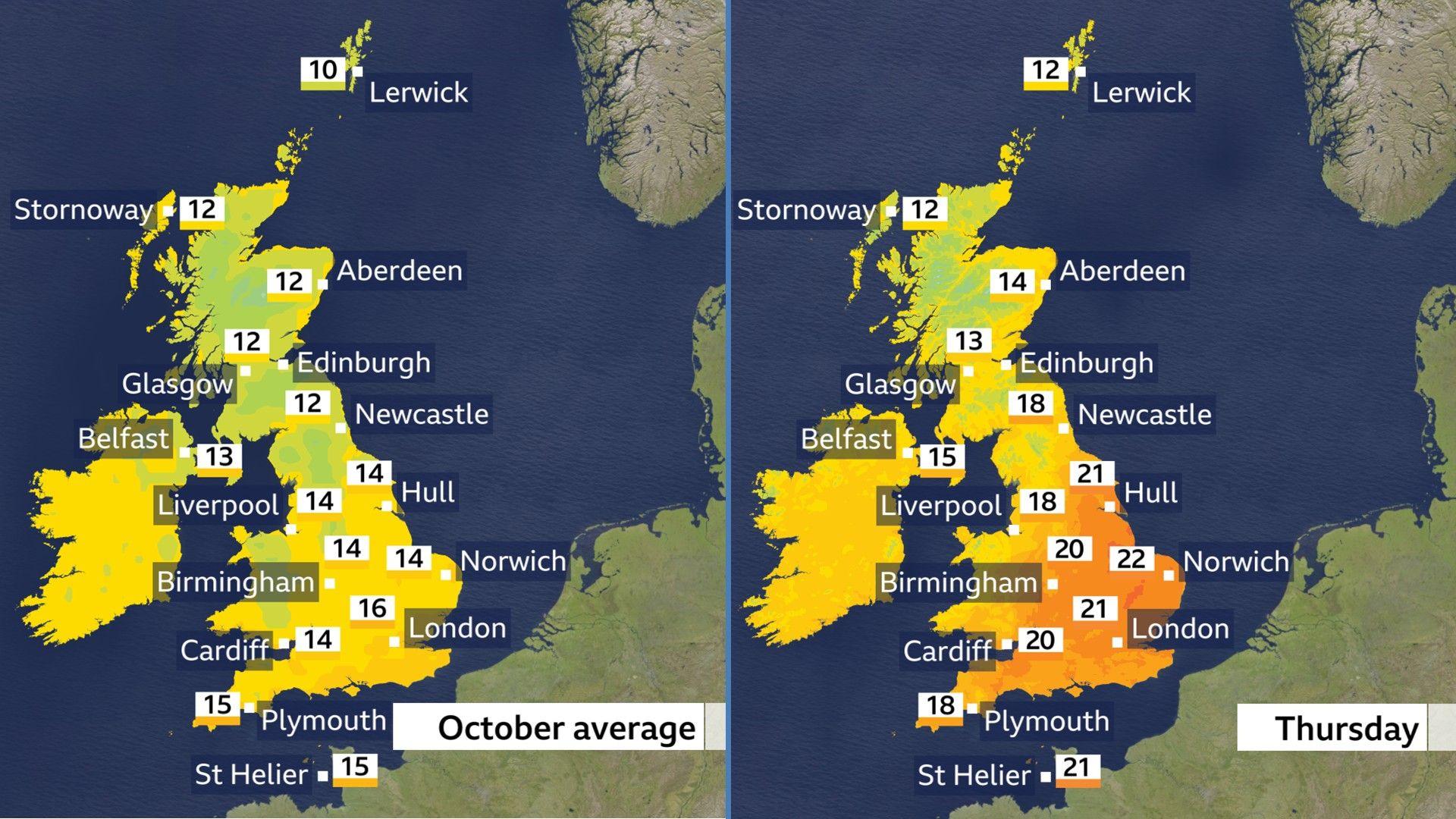
As the rain band clears from northern parts of the UK, Scotland and Northern Ireland will turn mostly sunny with blustery winds and scattered heavy showers.
Afternoon highs here will be around 12-15C (54-59F) and these chillier conditions will be a sign of things to come for the whole of the UK, with colder air set to spread southwards by Friday and linger into the weekend.
Feeling autumnal
High pressure will take charge of the weather for the end of the week providing sunny spells in many areas.
A few showers are also possible – especially in the north and west of the UK on Friday, then in the south-east of England over the weekend.
As the high builds from the west, widespread northerly winds will develop delivering colder air and a chilly feel.
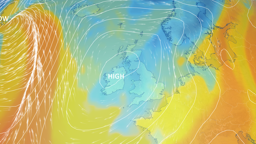
Daytime temperatures will end up near the October average, ranging from 10 to 16C (50-61F) across the UK, although it will feel colder than that where winds turn blustery – particularly along the coasts of eastern Scotland and eastern England.
The nights will also turn cold with single-digit lows in almost all areas and the chance of a touch of frost as well as some patchy mist and fog.
Thermometers are likely to dip below freezing in some locations in Scotland, Northern Ireland and northern England.
For some places it could be the coldest weather of the autumn so far but it is worth noting that these temperatures are not unusual for this time of year.
What is the long-range forecast?
There is a lot of uncertainty about the forecast for next week with conflicting signals from computer weather models.
High pressure is likely to remain close to the UK initially but there are signs that Atlantic weather systems will eventually break through, powered by the jet stream, bringing a return to wetter, windier and somewhat milder conditions.
However, there is uncertainty about how quickly that change will take place so it is worth keeping an eye on the BBC Weather website and app.
You can read our latest thoughts on the forecast even further ahead in our monthly outlook.
-
-
Published6 days ago
-
-
-
Published1 day ago

-
-
-
Published11 September

-