

This post was originally published on this site.
Why this heatwave feels worse than the last one
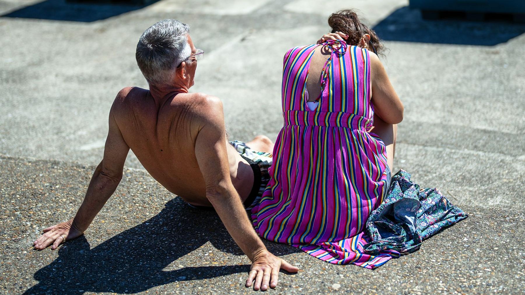 Image source, Getty Images
-
Published
June temperature records are set to be broken this week as the second heatwave of the year grips England and Wales.
Temperatures are set to reach into the mid- to high 30s Celsius, like they did in May, making for a few very uncomfortable days and nights.
But for many of us, this heatwave will feel even hotter. Where the forecast is a maximum of 35C, it may feel like 41C.
That’s down to a combination of factors: an unrelenting heat dome, high humidity, and back-to-back tropical nights.
Heat dome is ‘driving force’ behind heatwave
The intense record-breaking heatwave in the UK and Europe has been caused by a static and large area of high pressure – also referred to as a heat dome.
This is the “driving force” behind the heatwave, Dr Akshay Deoras, senior research scientist at the University of Reading, told BBC Weather.
This weather pattern results in air sinking down through the atmosphere, which compresses and heats up as it hits the ground.
This sinking air also dries out, meaning no clouds can form, so strong sunshine is able to heat the ground up even further.
During the May heatwave the centre of the heat dome was over the UK, so the heat was able to build underneath it, rather than being pulled in from more humid places.
This week, it originated in the hot and humid sub-tropics and has been centred more over France where temperatures have soared into the 40s Celsius.
As it has shifted slightly further north and to the east, the result has been a south-easterly airflow causing hotter and moister air to spread into the UK.
This moist air results in much higher humidity and adds significantly to the heat stress.
Dr Deoras said: “This is not just a heatwave, it is a heat-dome driven furnace that will grip most of the southern UK and push temperatures into truly exceptional territory.”
High humidity prevents the body from cooling down
The hottest areas of the UK – namely southern England and parts of Wales – will see the thermometer rise to 38 or 39C, and this becomes particularly uncomfortable when you factor in the humidity.
Humidity is a measure of how much moisture is in the air.
During hot weather our body controls our internal temperature by sweating and as the sweat is evaporated from our skin, it cools the air directly next to us, making us feel cooler.
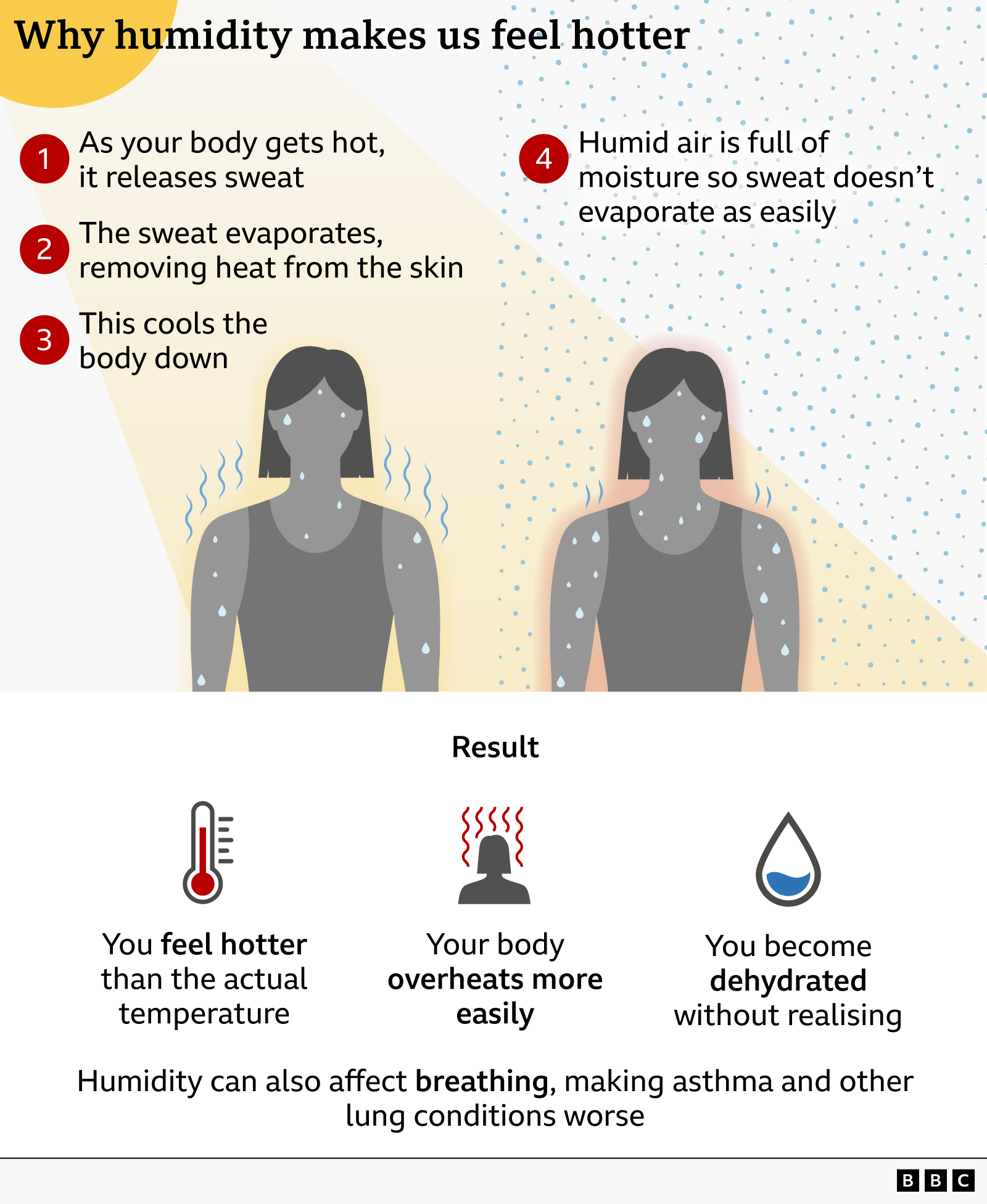
If the air is more humid, the sweat from our skin cannot evaporate and cool us down as effectively as it would do if the air was dry.
Meteorologists can calculate therefore how the combination of air temperature and humidity feels – as a “feels like” temperature.
While the air temperature in the coming days might be 35C for example, it may actually “feel” more like it’s 41C due to the high humidity.
With temperatures nudging 40C, there have been some comparisons to the historic heatwave of July 2022 when the UK recorded 40C for the first time.
But during that heatwave the air was very dry. So, while headline temperatures were higher then, this June’s heatwave will feel hotter and potentially have more health impacts as a result of the humidity.
-
How to keep your home cool in hot weather
-
Published2 days ago
-
-
What extreme heat does to the body
-
Published30 July 2023
-
-
How to sleep in the heat
-
Published2 days ago
-
-
Can you keep your kids off school or refuse to work during a heatwave?
-
Published1 day ago
-
Night-time temperatures bring little relief
Overnight temperatures will remain high this week and some locations will not get cooler than 20C. These are called “tropical nights”.
It is likely we will see the warmest June night on record on Thursday night as minimum temperatures across Wales, the Midlands and the South East are not expected to fall below 21 to 23C.
Some places could be warmer than the current UK and England record of 22.7C set in 1976, and the Wales record of 20.3C – set just this week.
“Feels like” temperatures may be even more noteworthy during the overnight period, when it may feel like 27C even at the coolest part of the night.
This is a major distinction to previous heatwaves in the UK.
During the hot spell of July 2022, for example, much of England and Wales experienced tropical nights – though few places had more than two consecutively.
In this heatwave, some locations may see three or four tropical nights in a row which becomes far more impactful.
This means the body will not be able to cool down in between daytime spikes in heat.
Though this is particularly dangerous for vulnerable people, it can put healthy individuals at risk too, leading to poor sleep, cardiovascular stress and a greater risk for heat exhaustion in subsequent days.
As the planet continues to warm, heatwaves like this will only become more common.
“Unless we drastically cut down the emission of greenhouse gases, global warming is not going to stop. In fact, it will accelerate,” Deoras said.
“A warmer atmosphere holds more moisture, so the combination of increased temperatures and humidity is what is likely to make humid heatwaves like this become more frequent and more intense.”
-
-
Published2 days ago
-


