
At least seven months of relentless rain needed to end drought, research shows
-
Published
Above-average rainfall is needed across England for the next seven months for all areas to recover from drought by spring 2027, according to new research.
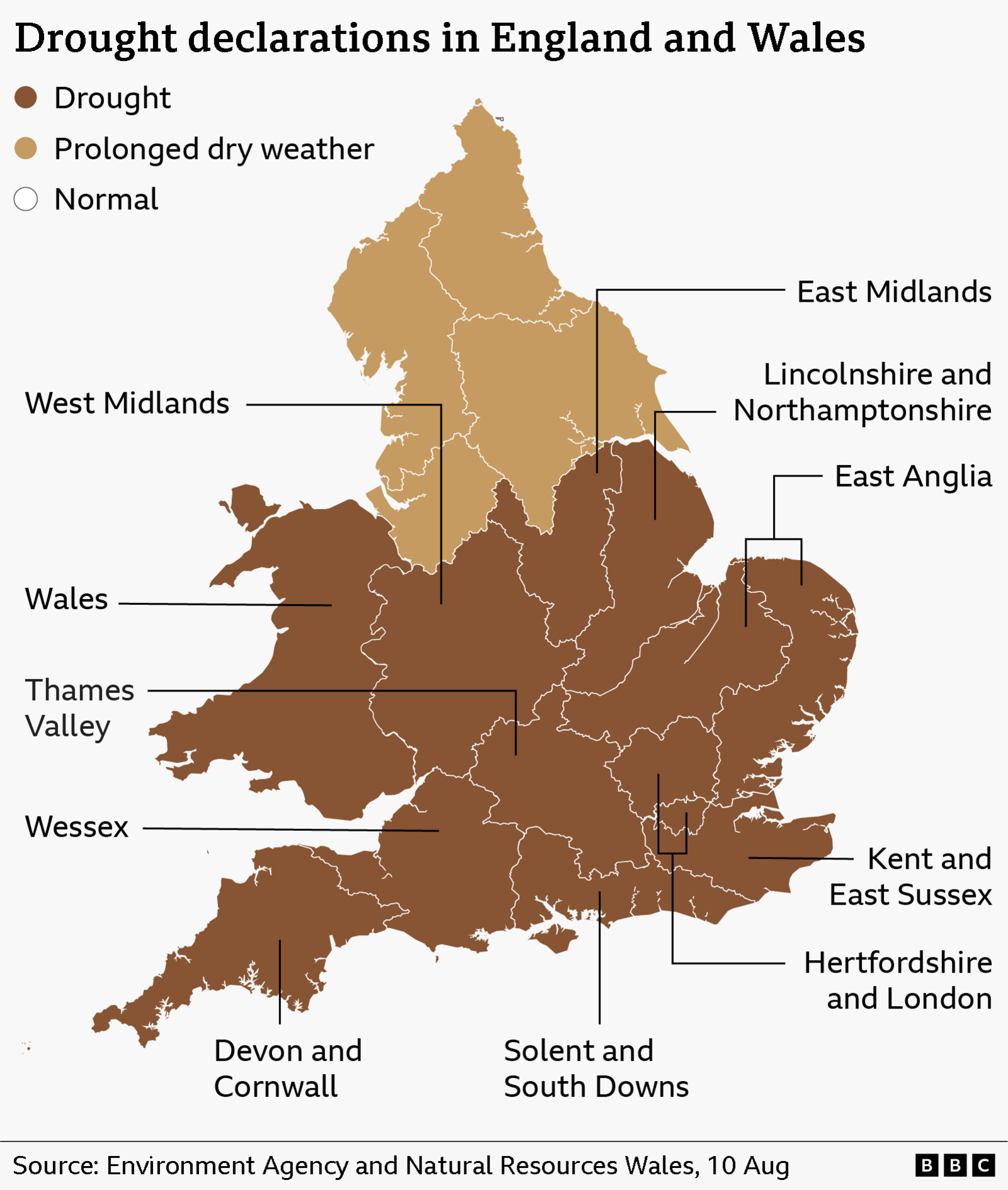
The Environment Agency (EA) stated that despite some wet weather during the first half of September, almost three-quarters of England remains in drought following an exceptionally dry spring and summer as well as a succession of heatwaves.
It says around 120% of typical rainfall is needed between now and April for all areas to be considered out of drought.
Even under the most likely rainfall scenario – which predicts a wetter autumn than normal based on the latest Met Office forecasts – Devon and Cornwall and East Anglia could still be in drought by the start of spring 2027.
Other predictions suggest there is also roughly a one-in-four chance that around half of England will still be in drought next spring, and currently around a 1% chance of a severe drought in the coming months.
The EA defines severe drought as a situation where water shortages have extensive and lasting impacts on the environment, farming, communities and the economy, and where there may be a serious threat to public water supplies.
England has not seen a severe drought since 1976.
Recent rain has brought some relief, however, groundwater levels remain low and reservoir storage across England stood at just under 57% last week, around a fifth below the level normally expected at this time of year.
EA Chief Executive Philip Duffy said: “The drought situation remains very serious, and we cannot underestimate the challenge ahead over the coming months.
“A few weeks of rain cannot reverse the deficit we face from the very dry spring and summer. We still need everyone to use a little less water to speed up the drought recovery.”
In Scotland the recent rainfall has not yet reversed the impact of months of dry conditions around parts of its east coast, with four areas now at significant water scarcity whilst the whole of Wales also remains in drought status.
Significant water scarcity is declared when river flows remain below the recognised low flow threshold for 30 consecutive days.
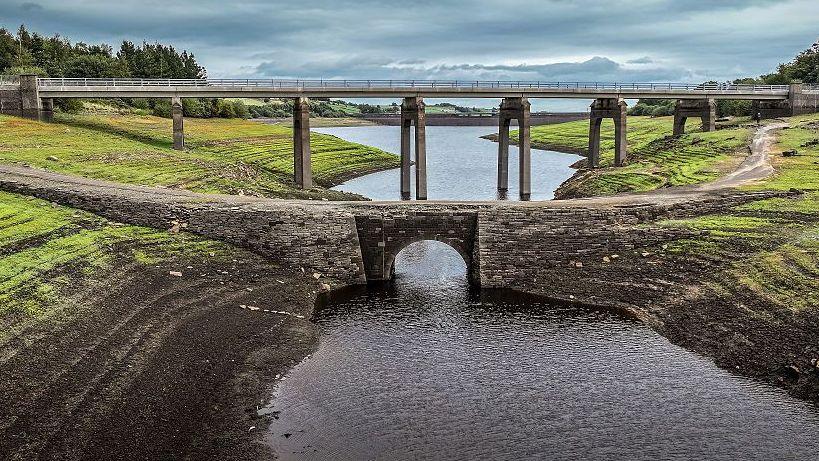 Image source, Getty Images
Is there rain in the forecast this week?
Although there is some rain in the short-range forecast, it is unlikely to be the kind of prolonged amount needed to alleviate the dry conditions over much of the UK.
Thursday will start off with some rain across south-eastern areas of England, taking some time to clear away from the Kent coast.
Sunny spells will develop elsewhere with some showers, especially across Scotland, Northern Ireland and northern England.
With an area of low pressure situated to the north of Scotland, there will also be some blustery conditions across the UK.
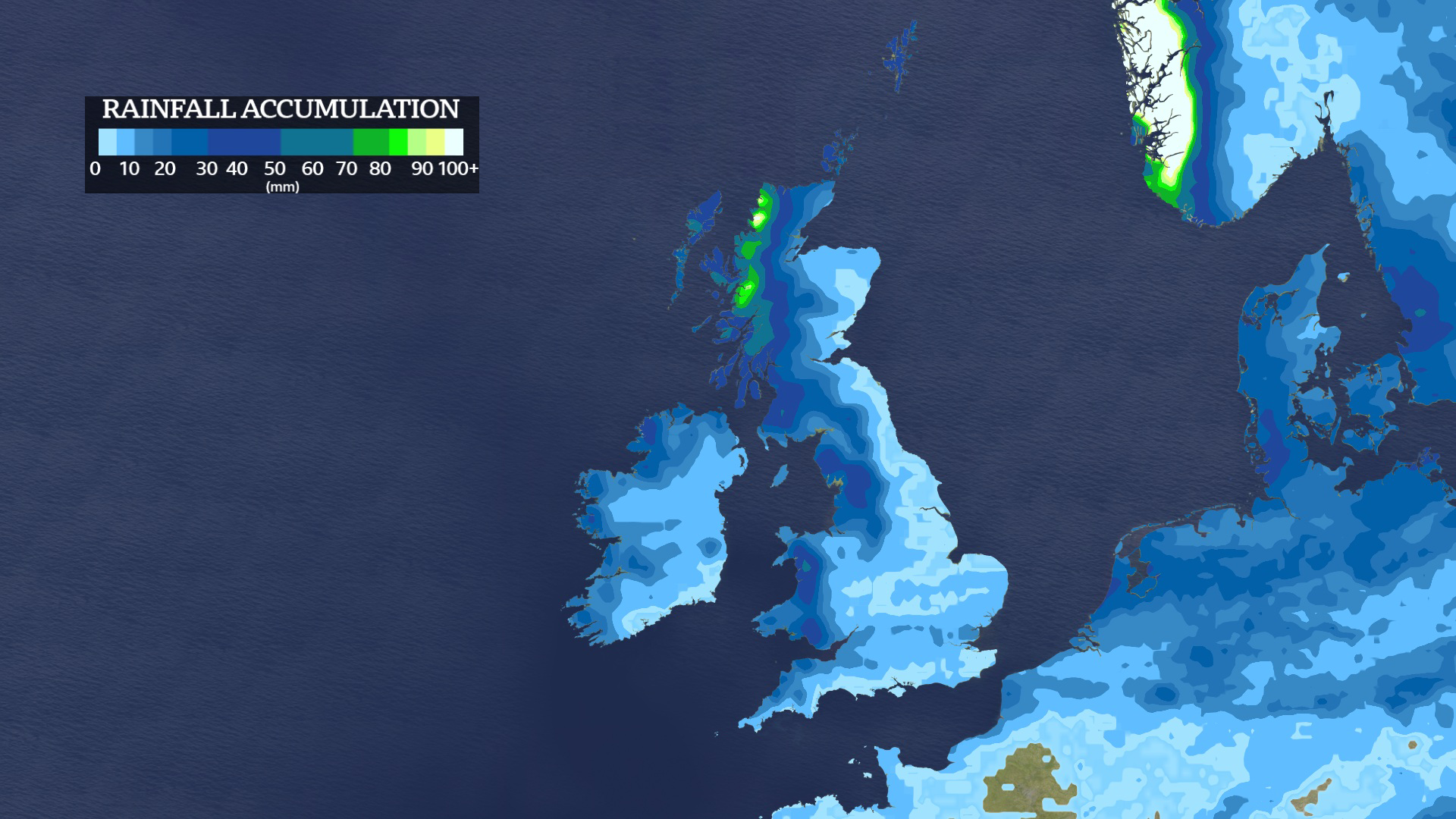
On Friday patchy rain will spread in from the west, followed by showers in the north-west on Saturday and in the south.
By Sunday rain and showers will ease, leaving largely dry and settled conditions into next week.
The Met Office is forecasting the second half of September will see a return to drier conditions, particularly in the south where the rain is needed the most.
-
Is there a hosepipe ban in my area? What you need to know
-
Published7 September
-
-
The race to stop England running out of water
-
Published29 August
-
El Niño’s impact on the UK’s weather
The latest seasonal outlook from the Met Office indicates an increased likelihood of a wetter-than-average autumn.
The current El Niño, which is already at near-record levels, is one of several factors influencing the outlook.
Historically El Niño events have been associated with warmer, wetter and stormier conditions across the UK in late autumn and early winter.
While wetter weather could help drought recovery, periods of heavy rain could also bring a risk of flooding.
The Environment Agency says floodwater can be difficult to store for public water supply because it arrives quickly and can contain high levels of sediment and nitrates washed off the land.
-
-
Published21 August
-
-
-
Published3 September
-
-
-
Published6 days ago

-